Feeds:
Posts
Comments

Archive for the ‘Mountains’ Category

We left Ath Muqam just after 3 o clock in the afternoon. The drive was immensely scenic. Road though narrow was metallic to start with interspersed with springs and water falls that bisected it, every now and then. The roaring river Neelum flows all along, it’s boundaries marked by lush green thickly forested slopes. Heavily guarded, we encountered the Military check posts and structures frequently. At the scenic spot of Karen, the divided states of Indian and Pakistani Kashmir converge together with only the narrow strip of river separating the two. The picturesque villages, fields, houses and mosques were clearly visible across the border as the drive along the line of control continued for quite a few kilometers. Just when the glittering and pearl white murmuring stream flowing down the hills near Dawarian intersected our course, it reminded us of our climb across the pass from the far side a few years ago. The more we travelled, the more we were enchanted to the sublime atmosphere and the raw beauty of the valley. What adds to its rapt charm is the typically quaint and colourful architecture and embroidery that is evident even deep  in the heart of the valley. This delightful architecture is the hallmark of the remarkably attractive valley of Sharda along with its camp cities that were visible once we crossed a wide stream just before the town. Sharda is typically known for the remains of an ancient university that have stood the test of time and survive to date.

The lovely corn fields that swayed and greeted us

The lovely corn fields that swayed and greeted us

Amazing valleys of Kashmir

Amazing valleys of Kashmir

A quaint mosque across the river in Indian Kashmir

A quaint mosque across the river in Indian Kashmir

Yes! You have to cross that on wheels just short of Sharda

Yes! You have to cross that on wheels just short of Sharda


The scenic valley of Sharda

The scenic valley of Sharda


From Sharda onwards, the road became increasingly bumpy and muddy but equally mesmerising. Located at just about 23 kms from Sharda, it still took the jeep more than two hours to reach Kel.

The valley of paradise! Kel

The valley of paradise! Kel

Nestled between the lush green mountains and plateaus_slopes rolling down from everywhere, all the way down to the twisting serpentine of gushing river Neelum that bisects the verdant meadows and Military setups and checkpoints sprinkled here and there, marks this stunning small paradise of Kel.

Having negotiated the worst of road and weather conditions, when the jeep approached the lovely settlement, it felt truly unbelievable. What rendered the whole episode dreamlike were the unbelievable sequence of events that had unfolded during the course of the day, one following the other, while at the same time we were overwhelmed by the pristine beauty and simplicity of the town and the engrossing atmosphere that was prevailing. Tiring, cold and rainy as it was, we took a simple but delicious meal, rented a room in a small hotel and went to sleep.

Crossing the river bridge downstream of Kel

Crossing the river bridge downstream of Kel

The jeep that took 2 dozen people to Domail (Like a herd!)

The jeep that took 2 dozen people to Domail (Like a herd!)

Our jeep track to Domail

Our jeep track to Domail

When we got up next morning, it was still overcast and damp. Our next destination was upper Domail. Under normal circumstances, there is a probability that one can hire a jeep right from Kel. However, the heavy rain had dismantled the makeshift wooden bridge located a couple of kilometers downstream. This necessitated taking about half an hour long walk along the Shaunter nala while we marvelled at the amazing beauty of the valley. Since we crossed the quaint bridge and moved to the far side of the stream in the morning, the probability of finding a jeep was higher. Fortunately, we were able to find a jeep parked there that took about another hour to amass the passengers and initiate its journey. From there, it was nearly twenty kilometes long jeep ride that took more than two hours as the jeep tootled along the twisting ascends while literally exposing the virtual heavens to the travellers. The bumpy mud and rocky track laid on a steep gradient eventually led us to upper Domail_ a lovely mountain village located near the confluence of two mountain streams. We pitched our tent, hired the porters for the next day and took our lunch. The scented breeze was immensely refreshing and invigorating whilst the serene charm and intoxicating aura of the isolated narrow valley trapped within the towering peaks far from the reach of civilization was truly fascinating.

More to follow…..

Read Full Post »

It was challenging from the very onset. Approaching from the Garhi Habibullah’s side,  bus came to a halt at a sharp turn a few kilometres short of Muzaffarabad. The near vertical fragile face of the mountain was bleeding. A slurry of mud and rain water flowed across the eroding muddy road channeling its way into the river deep down.

In a steady down pour and a welcoming moist breeze on a very pleasant August morning, we wore our raincoats and backpacks and began to stroll. Once we were able to cross the heaps of soft mud and make our way watchfully across the landslide, the road became more stable. A couple of hundred meters ahead, walking on a higher platform, the beautiful valley of Muzzafarabad met our eyes surrounded almost completely by the roaring serpentine of river Neelum.

022

024

Few minutes walk down the road accompanied by the scenic views of the valley washed by the rain,we were offered a lift by a random UN vehicle that was gratefully accepted. The roads were noticeably vacant and the traffic was understandably sparse but what was most revealing and shocking was the fact that the bus stop was completely vacant. It had been raining heavily and incessantly for days and all the approaches to Muzaffarabad were reportedly blocked. There was no public transport entering or leaving the town.

Determined and not prepared to let our plans fizzle, after much deliberation, we finally convinced and negotiated with the sole rent a car driver to take us a few kilometres further to the verge of landslides blocking access to the Neelum valley. Twenty minutes later the driver dropped us pointing towards a series of weeping and melting slides containing abundance of water and mud but equally considerate to the innocent desire and cause of an occasional stone or a piece of rock that hastily wanted to find its way down the slopes. The driver greeted, shook his head in disbelief but then thought the better of it, charged his bill dutifully and drove back.

WELCOME! LANDSLIDES THAT GREETED US ON OUR WAY!

WELCOME! LANDSLIDES THAT GREETED US ON OUR WAY!

Walking in the rain, keeping an eye on the weeping mountain while balancing ourselves, we began to cross the series of intermittent land slides that spread for a couple of kilometres. It all went smoothly supposedly until a couple of slides later, we were halted by a man on duty. He was supervising the clearance of the road while the machinery was at work. We were advised to wait until the reach was clear and no one was allowed to walk across.

As one testing ordeal followed the other, much to our delight and hope, the approach was cleared shortly and we were allowed to stroll further. Soon we realized there were heaps of mud and gravel scattered along the road with vehicles and bikes stuck in between. Some of the guys who had gone through some miserable conditions over the past couple of days had a strong warning to utter. However, our resolve kept us going.

Short of Khori, when it all looked highly improbable, with a stroke of luck, we were able to negotiate a deal with a pick up driver who agreed to give us a ride till Ath Muqam. We embarked on our next leg of journey. There were intermittent slides posing serious challenge but the driver full of commitment managed to cross every barrier skilfully. The landscape became increasingly scenic while the rain lent even more lively tinge and glow to the exuberantly rich and green panorama. Even though we were thoroughly wet and the torn canvas spread over the top of the vehicle was also leaking, the bewitching beauty and atmosphere of the valley was truly gripping. As much as it seemed improbable, it took us three hours to be transported to Ath Muqam. Not surprisingly, the place was equally deserted. The bus stop presented a sorry and disappointing look with no signs of conveyance visible. Just when it seemed, it was over for the day & possibly the trip, the invisible divine hand came to sort things out for us mortals again. Lurking behind the torrents of rain, there appeared the owner of one of the two jeeps parked in the deserted compound of the bus stand. Spirited by his unexpected offer to take us to not Sharda but even Kel in that inclement weather with a lot of premium understandably led to some heated negotiations under the thundering . He finally settled for a demanding price but hoped to drive us to Kel in another four hours by the sunset. Hungry but much conscious of the precious time that was lapsing, we settled for the sizzling pakoras, the only relishing delight available that we could lay our hands on, at the deserted bus stand.

More to come…..

Read Full Post »

One year later! The quest and journey takes us back to where we were. And the nature decides in our favour _ miraculously unfolding the heavenly scenes yet again. It all seemed like a continuity of our journey; connecting from where we had left _ though much sensational and challenging this time round.

Since there can’t be words to express or describe, I’ll let the pictures do the rest of talking on my behalf :

And let you be the judge 🙂 !

04022013446

04022013445

04022013458

For how long have you been standing like that babe!?  Overnight!

For how long have you been standing like that babe!? Overnight!

Get up boys! Its time to depart

Get up boys! Its time to depart

Oops! Looks like still got some work to do

Oops! Looks like still got some work to do

Who's gonna chain the monsters ? -6 degrees

Who’s gonna chain the monsters ? -6 degrees

Can I find my way out ?

Can I find my way out ?

The grueling start

The grueling start

04022013458

Carving the way out amid heaps of snow. Still 7 hours away from a semblance of civilization

Carving the way out amid heaps of snow. Still 7 hours away from a semblance of civilization

Read Full Post »

After twenty six hours of hectic journey from home, I asked the driver to stop the bus. With twisted necks and aching backs (lets not go down to more aching and sensitive areas for the time being), we disembarked the passenger bus at the narrow Raikot Bridge (1280m ASL) built over raging and gushing Indus waters. A gust of hot dusty wind greeted us as did the towering barren rocky mountains surrounding the narrow gauge in the middle of nowhere. My only companion looked at me in utter disbelief searching for some signs of insanity. In my defence, ignoring that probing look, I wore my backpack and braced my hiking stick pointing towards the rickety jeep-likes reassuringly as I started walking across the bridge. The young man followed helplessly.

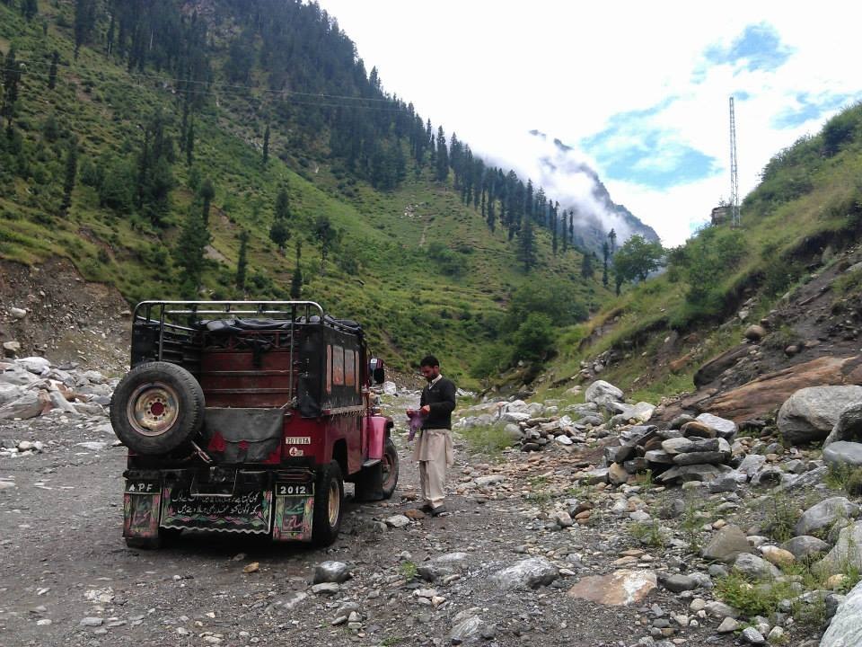
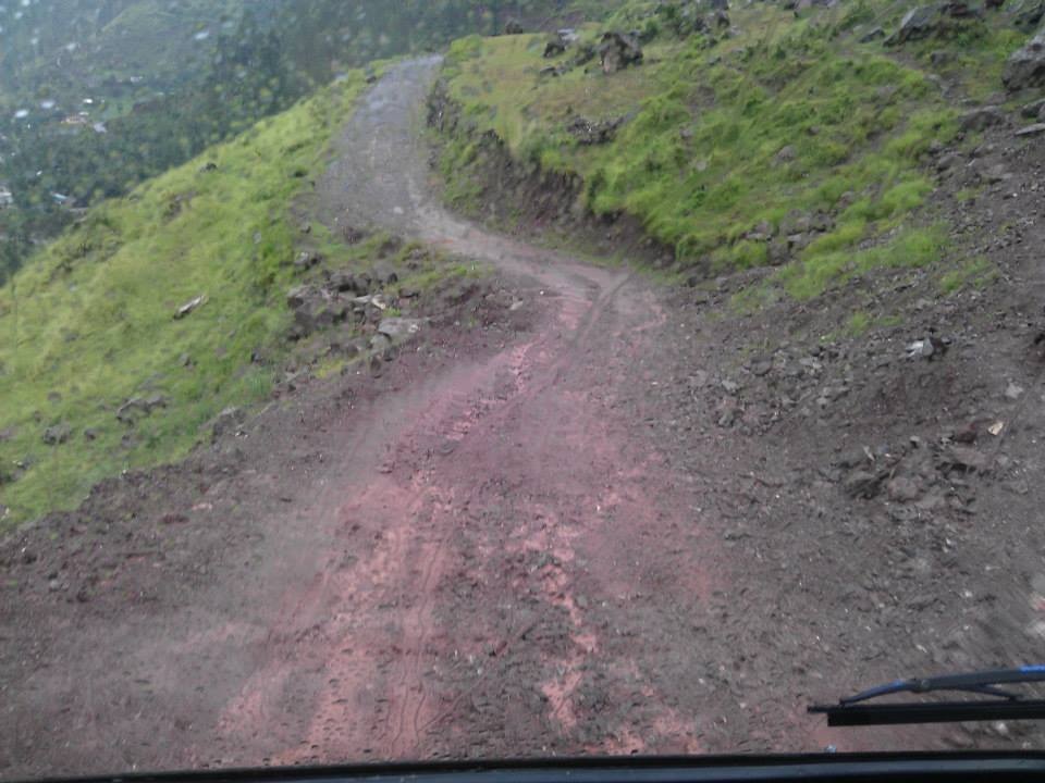
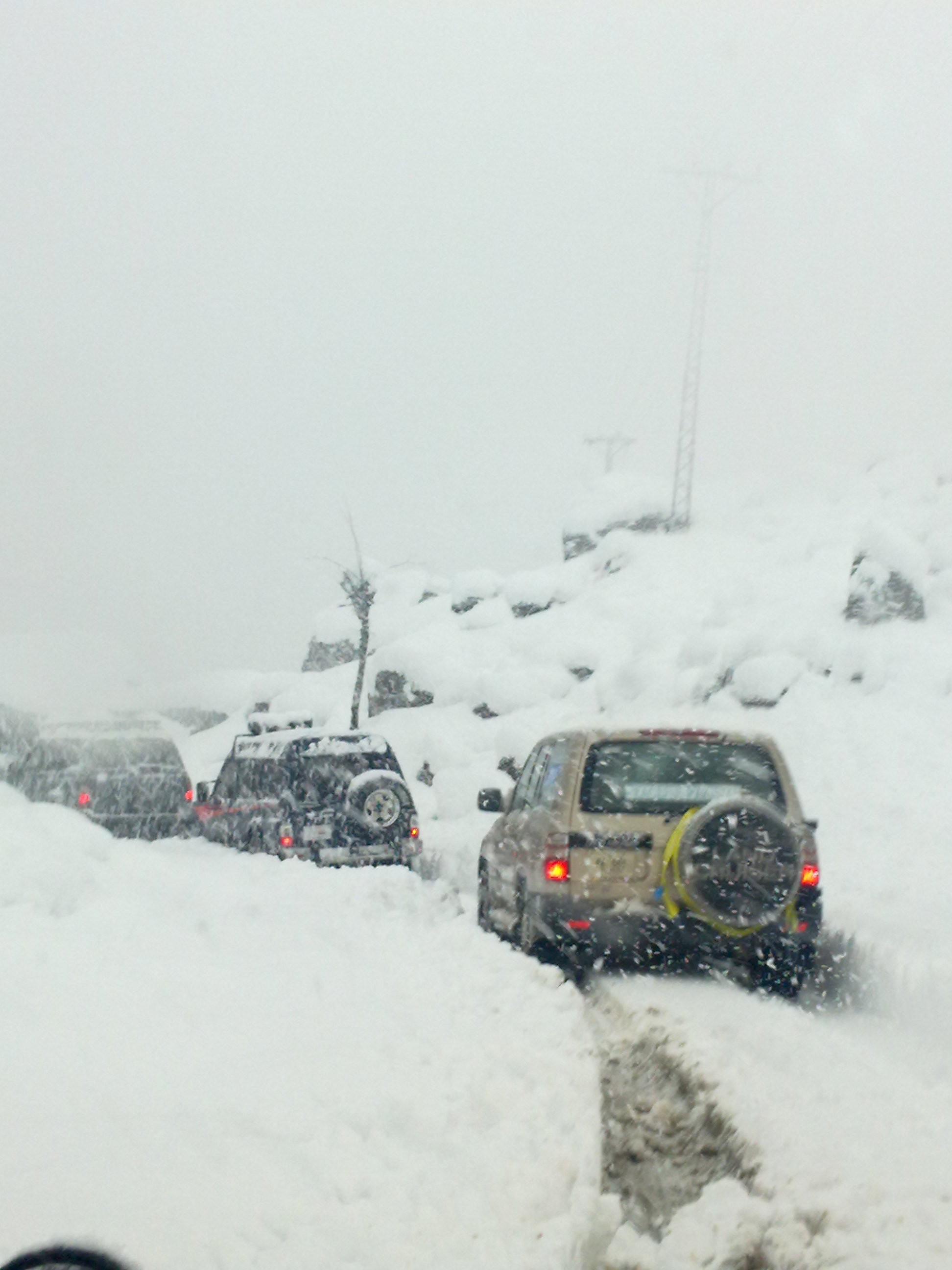
We embarked on the jeep_ the first one in the queue offering a standard deal. Soon we found the fit for purpose, strange modern day innovative invention ascending and negotiating unbelievably sharp twists and turns disappearing into the barren mountains. The narrow stony track laid on loose rocks and soil along the precipice was an amazing engineering marvel; As if cut and laid to perfection just to accommodate the pair of tyres separated by a standard tie rod and nothing more. Extension of a singular inch would have meant a complete waste of resources. A negative error in width, however, remains both acceptable and a possibility.

Driving that jeep-like requires special skills and merits particular mention; Whereas, the right hand stays firmly on the steering wheel, the left continuously juggles and orchestrates between the steering wheel and hand break moving in exemplary rhythm and in sync with the foot juggling between the clutch and brake pedal. The spasmodic juggling and dancing of the struggling driver continues for well over an hour before you are transported to a lovely green speck amidst the towering barren mountains named after the hot springs flowing there_ Tato.

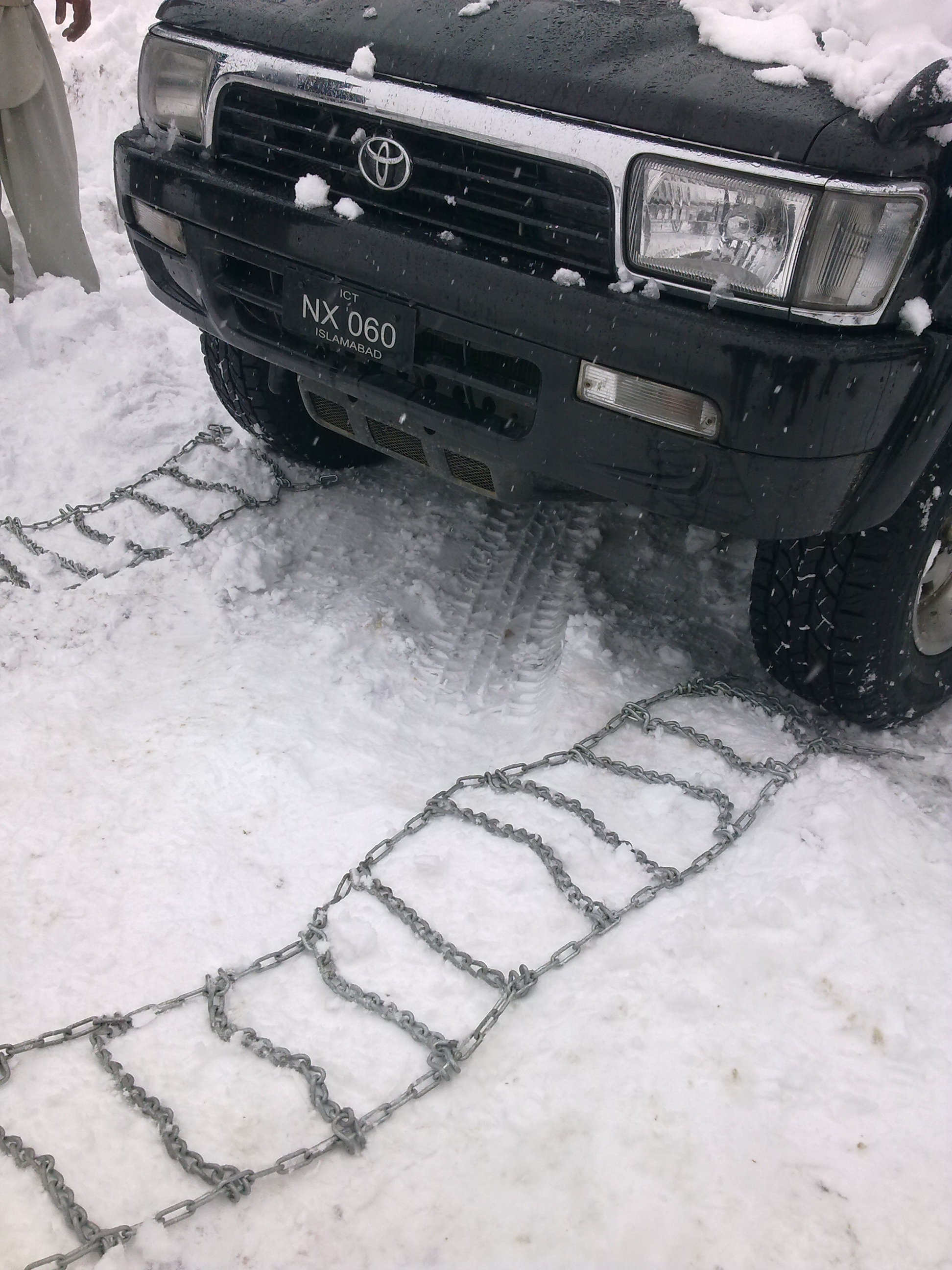
See! Jeep wider than the track

A serpentine? Meandering track clinging to the face of the mountain along the precipice

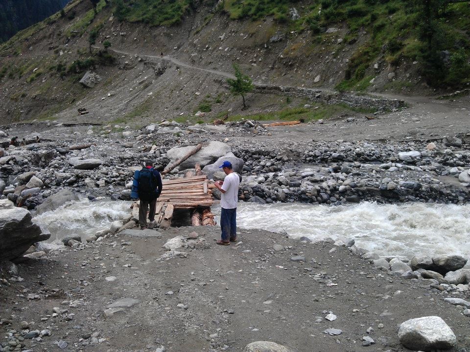
The collapsed old bridge provided the first taste of the exciting challenge on the trip. While the re-erection was going on, all pedestrian traffic across the bridge was stopped. The only alternate was to cross the stream along a narrow reach where the makeshift path on reposing face of the muddy formation of the mountain was continuously dissolving and sliding.

Bed of roses! Crossing the stream

Erecting the bridge; Community at work on self help basis


If you are lucky and a chosen one, you are able to hire another jeep across the bridge for a short ascending ride to a place called Jhail. Welcome to the reality. Yeah! That bites. That is where you have to start the trek officially. Standing in the blazing sun that is beating down; Amidst stony rocks radiating all the afternoon heat; Landscape sparsely vegetated; A gushing mountain stream flowing through the gourge and the towering snow clad Bulder peak, from its immense heights, staring down at you.

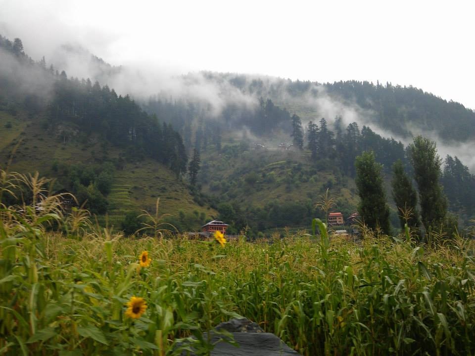
You trail down, cross the stream and continue to walk upstream along a moderate grade. Half an hour or so on the trek, along a path that begins to sprout junipers and pines, you are led to the Fairy point; The first potential stop over in a peaceful spot at an elevation of 2,666 m with abundance of water.

And then they insist on calling it ‘Fairy point’

Brace yourself up for all the challenge and excitement that ensues. The hike to Fairy Meadows is amazing but a bit demanding. You start your walk along a stony and muddy trek laid in a narrow gourge surrounded by lofty mountains. Following a moderately steep grade that ascends sharply, the distancing raging stream and the ravine getting farther down, the landscape begins to widen and unfold, exposing the overflowing treasures of immense beauty. With Rakaposhi at a distance right behind you, rapt charm and glory of Nanga Parbat peeping occasionally from behind a shroud of sky rocketing peaks, though dwarfed miserably in comparison with the matchless heights of the giant, all clad in white for kilometers, in particular, is almost spell-binding. 

The higher you rise, the bewildering it gets. Pine growth thickens_ Their fragrance permeating and suffusing the air. There is plenty of water and the landscape turns green and rich. Finally a sharp ascent and a demanding walk leads to the top of the wide plateau and an unbelievably amazing clearance marked by verdant meadows and thick clustered pines. The magical place is called Fairy Meadows.

Located at an elevation of (3,306m), the resort offers basic wooden cottages and camping to the tourists. Hot water facility, wash rooms, dining halls and basic electricity are the ultimate luxuries unknown to the trekkers else where in Pakistan where we have to thoroughly plan and organize it to the last nail. 

The meadowof fairies;

Fairy Meadows offers the most stunning views of the Nanga Parbat round the clock_ its changing hues and shades, glistening in moonlight and sparkling in sun rise. The aerial views of the surrounding slopes, gourges, streams and mountains, once you walk to the edge of the ridge showcase mesmerizing beauty. Serene ‘Phantoora’ lake exhibiting its mythical beauty is known to host and attract descending fairies, unfortunately, not when the devils (like me) are around. Murmuring water courses with refreshing and revitalizing ice cold crystal clear mineral rich water add another scale and dimension to the dreamlike atmosphere. Natives are extremely hospitable, courteous and welcoming yet you are not supposed to take pictures of their settlements and ladies in particular.

Lush green pastures of Fairy Meadows

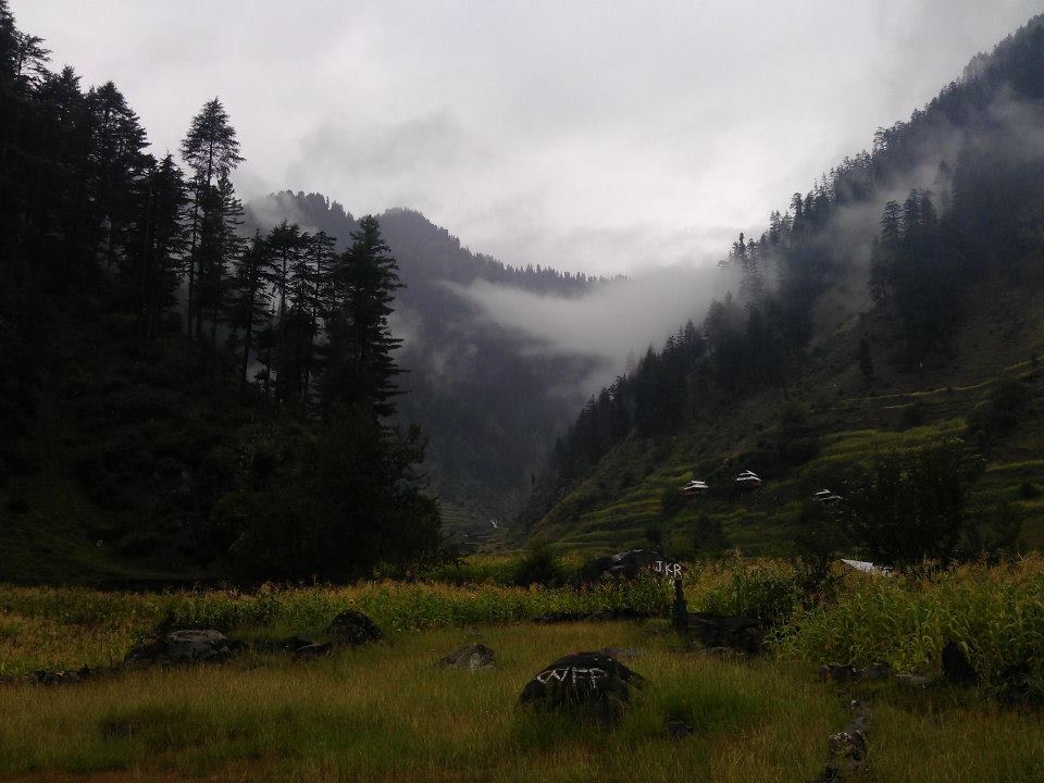
A gradual uphill afternoon walk on a trail that runs amidst a thick cluster of pines along a murmuring stream unravels the idyllic heavens on way to the scenic Beyal camp. Beyal camp ( Beel camp in some books) is a small romantically tranquil camping spot located right at the foot of towering peaks by the stream at few kilometers from Fairy Meadows at an elevation of 3,500m ASL. Well clear of the pines and growth, the vista is wide and clear, the place appears as if captivated amidst a cluster of magnificent heights. 

Quaint flavour of life; Beyal Camp

A scenic walk to pictursque Beyal Camp

The trek traveling upstream along the stream from the Beyal camp is gentle to start with. You encounter lush green grassy planes and junipers along the course. Gradually, the ascending trek leads you to a lone giant rock standing at the verge of a vertical cliff. As if the skies shift and part, an unbelievable and mind-blowing horizon of surging peaks, huge masses of snow and glaciers encompassing the world around you appear in close proximity invading your field of view.  This is lower view point (3,667m ASL). 

From thereon, it requires shifting gears with the trek offering greater degree of challenge and resistance. First of all, it is a stiff walk up the steep hill along the inclined face covered with birch trees. You part ways with the stream and gain height quickly, the views becoming increasingly scenic. Frozen Rai Kot glacier running for miles endlessly, the crevices with gaping mouths belching at every drop of a slide or an avalanche. Once you climb to the top of the hill and further beyond to the upper view point, the vistas expose a whole new surreal world before your eyes. You literally see the clouds of snow soar to the skies accompanied by thundering sound of avalanches intermittently at one point or another. That is where you find yourself enclosed within a cluster of peaks surging jointly in formation of a half circle comprising the most lethal, naked and vertical north face of the killer mountain Nanga Parbat (8,126m ASL) as if offering an insurmountable resistance and line of defence with howling terrifying seracs and avalanches guarding the majestic heights, ridges and cliffs of royal Nanga Parbat. From north to south, roughly, the peaks stand in order of Bulder (5,602m), Rai Kot (7,070m), Chongra ( 6,448-6830m), Silver saddle or Daimer Gap, Ganalo (6,608m), Juliper North and South( 5,245m & 5,206m) together with immense unruly glaciers running for miles and miles.

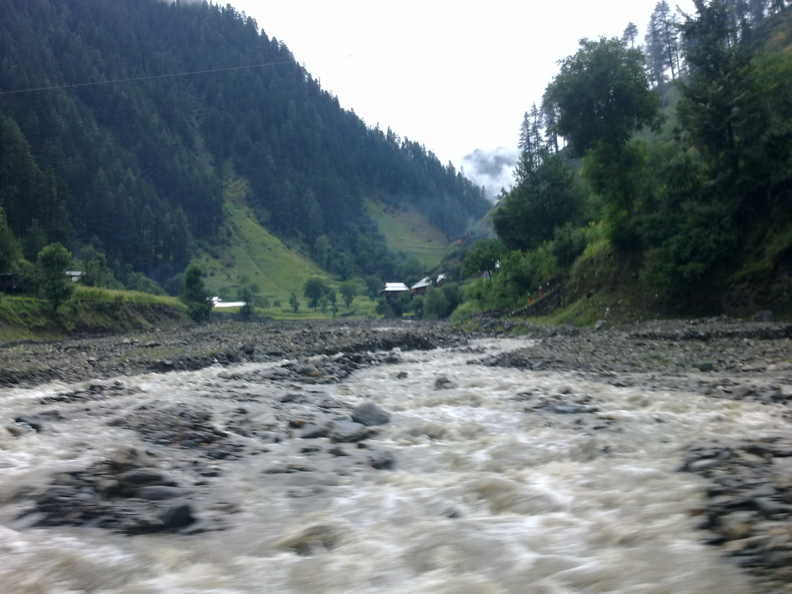
On your trek to Nanga Parbat base camp following a walk on a narrow goat path along a ridge overlooking Rai Kot glacier, it descends to a stream originating from the melting Ganalo glacier. The water level soars significantly as the day progresses thus making it harder to cross later in the day. Once you cross the stream, the trek rises to the top of a ridge on the base of the snowy mountains. Another descent leads you to a narrow reach of Ganalo glacier marked by ice walls and big boulders affording access across the glacier where you listen to the melting and trickling of ice blocks right under your feet. 

Crossing Ganalo glacier; On way to Nanga Parbat base camp

Vertical heights; Either keep your eye on the top or keep your cap on your head. Choice is yours!

Following the glacier, the trek rises again leading now to a wider grassy plane and meadows in the wilderness with wild flowers above the tree line. Nestled between the monumental peaks, Nanga Parbatbase camp (3,967m ) offers breathtaking views of the surrounding mountains, glaciers and huge masses of snow and frozen world. Situated at a stone’s throw is Drexel’s Monument built in honour of four Germans and six porters who lost their lives in 1934 in a storm followed by death of seven climbers and nine porters who were buried alive in an avalanche that swallowed their camp in 1937. The latest in line was Karl Unterkircher who lost his precious life in his quest to climb the bloodthirsty monstrous North Face in 2008.


Steeped in exotic thrill, fun and adventure, the hike is besieging and ecstatic right from the word go until that nostalgic moment when you cross the dangerous wooden bridge over the hundreds of feet deep ravine and throw your backpacks into the jeep again only to return to the dins of life across that land of fantasies that gradually sinks and engraves itself into the layers of your memory with each distancing moment and mile.

Read Full Post »

It has been one bewildering week. Soaked in freshness, permeated in raw beauty, bathed in exuberance. Loved every minute and moment of it_ Like being transported to a surreal land and heaven of fantasies, dreams and fairies_ And it all felt so intoxicating and unreal; So out of this world! 


Felt like reaching out to the skies and touching the naked face of vertical cliffs and majestic mountains. A cluster of glorious peaks encompassing the mere mortals, from one end to the other, making everything look so ordinary and microscopic in comparison with the grand scale of the surrounding universe.


More to follow. Until you begin to get a feeler and a vague idea what the experience must have been like!? And just wondering, if you can figure out and name the places, I have been most fortunate to set my foot on. Lets see!?

Read Full Post »

And this time around it was just not a hike. What spiced up all the fun was what followed shortly. On our way back to Abbottabad from Nathiagali we took the new partially completed alternate road being laid. On its winding course it leads to a lovely water fall locally known as ‘Aab Shaar’.

Aab Shaar ( The Waterfall )

 The narrow road bisects the thick heavens of pine jungles unveiling the idyllic beauty of the mountains, villages and lush green fields. Permeating raw beauty and purity that suffused the environs reminded me of the childhood trips on now much developed and commercialized Nathiagali Abbottabad road being brutally stripped of its natural treasures.

Guess what! The best part is yet to come. Upon his insistence, we decided to stop at the native village of one of our mates near Bagnotar who was accompanying us on the trip. As it turned out, the lovely mountain village perched on top of a hill sat romantically across a hundreds of meters wide and at least one thousand feet deep ravine. The only alternate access, other then crossing the stream on foot, is rendered by means of an innovative generator operated cable car look-alike installed by one of the domestic investors.

‘Galiyaat Cable Car’

 Just like the sighting of the Eid crescent ,the instantaneous sighting of the queer conveyance gadget without appropriate warning triggered a couple of immediate in volunteered reactions. As expected, I went berserk with thrill and excitement, adrenaline pumping high. To an equal or even greater disappointment, the mates refused to take the risk of the ride. It took the best of my negotiations and motivational skills, some oratory, eloquence and rhetoric, rich incentives and good emphatic fifteen minutes of coaxing to finally win all the votes if not hearts.

The ride, eventually proved to be much fun. No less thrilling than the cable car ride to Santusa islands from Mount Faber in Singapore or a long delightful ride to Genting heights near Kaulalampur. The village was a blend of colours , revealing a glimpse of gay rustic lifestyle and culture with increasing infiltration of modernization and urbanization. Adobe houses are paving way for concrete construction, the slanting tin and asbestos roofs being ruthlessly replaced by flat roofs. The arenas are getting bigger and wider whereas the households are shrinking to smaller numbers progressively diminishing the sense of sharing in all probability. The simplicity and naivety is losing its irresistible spontaneity, although the exemplary hospitality, warmth and open heartedness prevails and I sincerely hope it lasts as it steadily has for centuries.

Read Full Post »

The bewildering 39 kms long trail that runs from Thandiani to Nathiagali and unveils the heavenly beauty of pine covered ‘Galiyaat’.


Dilapidated kitchen look alike at Dagri Bangla


Ruptured forest bangla at Dagri. Never repaired following the massive 2005 earthquake. The word is that the structure is going to be demolished soon.


A sublime sunset


Our sweet lil abode 🙂


A breathtaking view of Nathiagali from Miran Jani top; The heighest point of 'Galiyat' 9,561 ft ASL overlooking pine clustered Nathiagali


The poor natives; The unwashed masses


The quaint Church at Nathiagali

Read Full Post »

In contrast to one of those momentous narrations & ostentatious bragging about scaling some monumental peaks or heights that go on endlessly, this is a recount of one of my recent preposterous misadventures. It was the last day of our sojourn at one of the newly established cosy hotels in Donga Gali during last August.

I woke up early in the morning only to find a chilly breeze and drizzle greet all of us. Unfortunately, no one was interested to saunter by. The atmosphere was too tempting enticing me to set off for the enchanting world stood waiting to be explored with all its besotting charm. Soon, I took the turn and started to climb the metalled ascent along the drive that runs through the historical buildings and hotels built in stone masonry and the vacation cottages with gaily coloured tin roofs and gables.

Along the highway from where the trek originates

Mushkpuri hotel; One of the oldest nestled in the hills

The mist was lowering veiling the breathtaking landscape in mild rain gradually. I continued to walk along the steep grade as the rain picked up.

Along the drive- One of the many views I found mesmerising

After a few minutes I approached the end of the paved lane marking the beginning of the thick forest. It had started to rain hard by then. But the mud track that lay before me bisecting the dense calm green was too irresistible. It was all unplanned and all I was carrying was my camera and cell phone- No backpack – No rain coat ; But as soon as I inhaled the moist heavy breeze laden with intoxicating scent of pines, I knew it was unstoppable. 

The ever gratifying encyclopedia courtesy Forest Department

Just in case you are inclined to hire the asses

As drawn by some invisible force, taking larger strides, I walked towards Lalazar and Mushkpuri top. Strolling along the face of the hill, looking down along the shelving dense green slopes covered with tall pines, for a short distance, I could make the diminishing signs of the meandering highway far below. Soon the trek disappeared in the dense jungle where I encountered all sorts of protesting voices, ranging from insects to monkeys, evoked by my unexpected foreign presence. 

Was I wandering in a fairyland?


It was a strange strand of intertwining and inseparable emotions, I was subjected to, being lost as a tiny speck in this wide expanse of wilderness. To be honest, I was sweating in rain and chill owing more to excitement and fear than exertion. But in the end the curiosity that had once killed the cat got the better of me and I continued. 

Once you start there is no looking back

 There was a huge log of a thick tree that fell across the narrow trek. Only way to cross the barrier was to climb and jump over the thick trunk. Having hiked for half an hour or so, there was a diversion and a sign reading Lalazar pointing towards a steep ascent. The grassy layers were subsiding making the steep trek muddy and harder to climb. Slithering, I tumbled upon one of the slopes and rolled on for quite a while discovering only much to my dumbness having recovered my senses moments later that the dearest wifey’s camera was all smeared in mud_ Lens, view finder, batteries compartment and all (how I went through the trial and painstaking process of detailed sapping interrogation is an adventure saved for another day) and its batteries gone and lost. The pair of jeans I was clad in was all daubed in mud as well and so was my sweatshirt. Not to worry about the joggers as those were already drenched and soaked.

In a shroud of haze


A drape of mist or green?

I moved on. My biggest regret and worry being, I would no longer be able to take photographs. But we all know, life can be so unkind at times. Nothing more eventful took place during the rest of the climb.

 On my return, I was consciously aware that it was cold and I was drenched and getting late. I hurried down the hill and jogging wherever possible. The last scare came from the barking stray dogs as soon as I stepped into the civilization again. But perhaps they soon realized that I was as harmless and astray as their wretched souls and they decided against it when I came to a complete halt.  

 I took a sigh of relief as I approached the hotel. But the shopkeepers looked at me with gaping mouths and bewildered eyes when I told them that I was just back from Mushkpuri. That didn’t count much. But what really counted was that I made it before the breakfast buffet was over and hungry as I was, I had the opportunity to unleash myself and devour all the food laid on the tables.

Read Full Post »

The queen of hills as it is majestically known, Murree holds a unique pedestal amongst the hill stations of Pakistan. Established as a sanatorium for British troops, that soon developed into the summer headquarters of Punjab government, the town was built in the middle of 19th century. Most significant historical land marks such as church and the “The Mall” were constructed in 1857 and afterwards.   

Located at a distance of 65 km and nearly 90 minutes drive from Federal Capital Islamabad, thickly clustered alpine paradise exuding bewitching beauty, remains highly accessible throughout the year. Perched up at an elevation of about 2300 m ASL (7500 ft), the hills remain draped in white sheet of snow mostly during December to March. The annual precipitation is nearly 1500 mm, in all probability, the highest anywhere in Pakistan. 

Golf course and hill resort of Bhurban, having an elevation of nearly 2000 m, are also located in the vicinity of Murree. Development of Murree expressway recently has rendered accessibility even better. 

A few pictures taken during a damp afternoon are attached here: 


PC Bhurban on a soaked day

Though one of the most charming places to visit, the influx of tourists much beyond the capacity and development has taken its toll. Lack of planning, human intervention and haphazard construction without any strict control or codes have contributed considerably to the environmental and ecological degradation. The green patches are being ruthlessly ripped away while heaps of debris are becoming increasingly visible. At times, even a stink of foul odours overrides the fragrance and freshness of the breeze that is the trademark of the overwhelming atmosphere. 

We have to act responsibly to preserve the rapidly depleting beauty and aura of the place!

Read Full Post »

As the spring sets in, everything springs up including our trekking plans for the year. To start the season, those who know of it, we go through the annual ritual and pilgrimage of walking through a breathtakingly beautiful trek that tears through the verdant meadows and alpine heavens running from Thandiani to Nathiagali. 39 kilometers in walking length, oscillating between 6500 and 9000 ft ASL, the warm up trek is known as a bed of roses amongst the trekkers of Pakistan. Forest rest houses provide lodging and camping options at Biran gali and Dagri, both 13 kms ( 8 miles )  apart. 

As it is not humanly possible to narrate the beauty and charm of the hike, a few pics taken during the last year’s hike taken by my friends ( all credit to them) , are uploaded to exhibit a glimpse of simplicity, purity and natural aura that pervades life in those mountains and valleys. 

A picture, as they say, is worth more than thousand words…….


As I relived all those moments, craving all the more to go through that remarkable experience all over again, how was your journey through the snapshots? Like to share a word or two?

Read Full Post »

Older Posts »